Original Article by Ann Galliard and Iain MacKenzie,
together with related local newspaper clippings. |
West Highland Telegraph, part of the
Universal Private Telegraph Company.
Steve Hiscocks wrote that UPT owned the
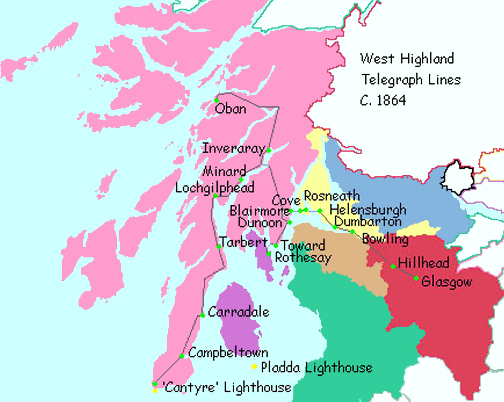
"West Highland Telegraph" line from Glasgow to Helensburgh some 35 miles to the W-Northwest and it was for paying the charges on messages over this line that stamps were issued in 1864.
Though that may have been the extent of the West Highland Telegraph in 1864, by 4 September 1865 it had been extended to the light house on the Mull of Kintyre (Cantyre). The speed was due largely to the fact that most of the land that needed to be crossed was owned by the Duke of Argyll who was much in favour of a telegraph system. In fact, according to an article in the Glasgow Herald of Wednesday, February 17, 1864; (Issue 7522), there was already a proposal to link Glasgow with both that lighthouse, and the Pladda, just south of the Isle of Arran. It had also been pointed out that from Cantyre to the coast of Ireland was only 12 miles, offering further opportunities.
Much shipping arrived in the area of the Clyde, destined for Glasgow, and the lack of lighthouses led to much loss of ships and life.
My Notes:
Registered on 20th. September 1860.
The business operated successfully in London, Newcastle, Leeds, Liverpool, Manchester, Glasgow and via the
West Highland Telegraph which they owned, the resort town of Helensburgh on the Clyde, 33 miles from Glasgow.
According to Steven Roberts writing about the West Highland Telegraph :
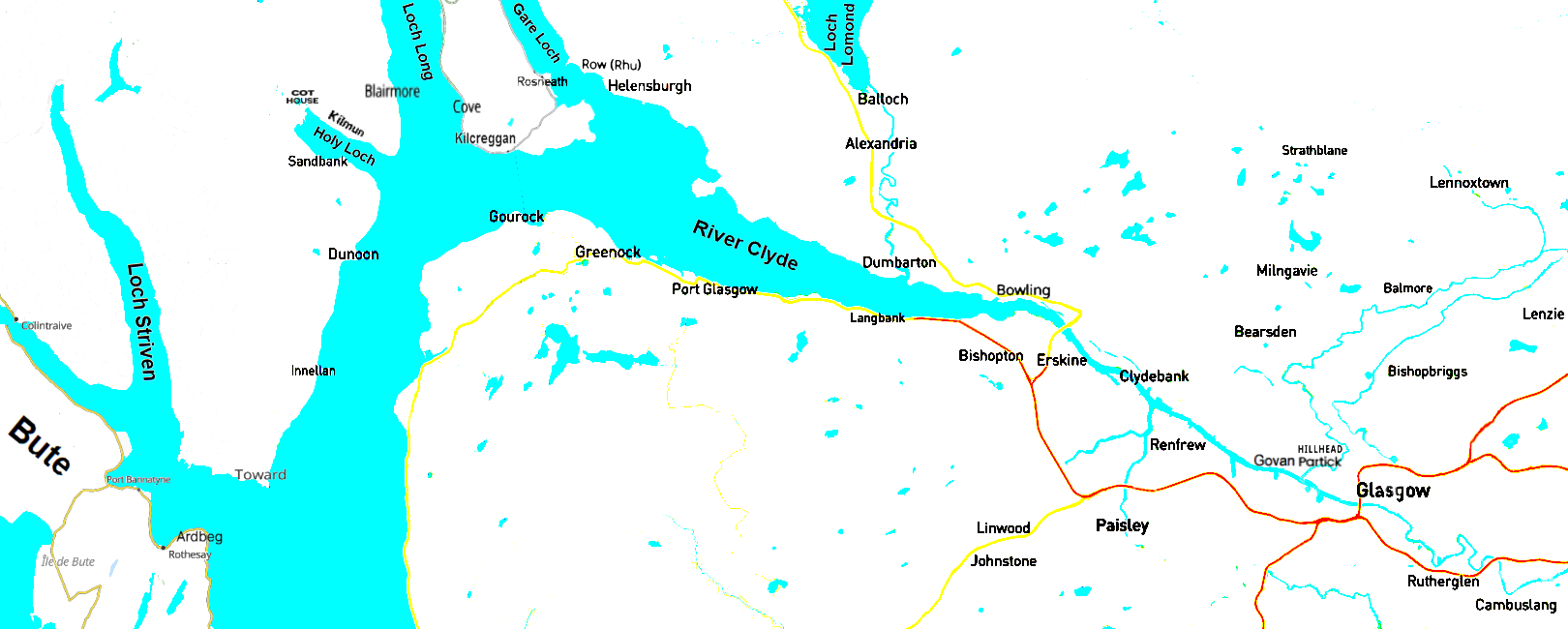
'The circuits were almost entirely "open wire", in the Company's terminology, consisting of iron wires on overhead poles; but they also included four short submarine cables across the lochs at Roseneath, Blairmore, West Craighead and Ardbeg. In length the circuits totalled 130 miles of line, of which 5 miles were underwater and a short length underground through Helensburgh. Its Cantyre lines ran from the centre of Glasgow along the north bank of the Clyde river to Helensburgh, Row[Rhu], Roseneath, Cove, Blairmore, Cot House and East Craighead to West Craighead; West Craighead north along the road around Loch Awe to Inverary and Oban; West Craighead south down the Cantyre peninsular to Ardrishaig, Campbeltown and the Cantyre Light on the tip of the Mull; and from Cot House south past Holy Loch along the west bank of the Clyde to Dunoon, Toward, Ardrie Point, Ardbeg and Rothesay. To these dedicated lines it also applied wires in its private circuits to Barrhead and Greenock to public use. '
This used 4 submarine cables and involved 10 individual lines.
It should be noted that John Pender, the managing director of the Atlantic Telegraph Company and a director of the
British & Irish Magnetic Telegraph Company, and later, creator of the Eastern Telegraph Company, had a country
house on the line and helped financially to support the station at Minaird.
Everett Ramsey has pointed out a further source of information on the
West Highland Telegraph at HistoricKilmun.org, which also shows the map on the left.
The image on the left is adapted from it.
The article is Reproduced on a new page, courtesy of the authors.
|