There are triangular postal markings that were intended for use with the cheaper "Printed Matter Rate".
Whilst some have just the post office number, others have a code that could be derived from old telegraphic codes.
The triangles are still postal.
The codes could also be simply made up, with any correspondence with the telegraph codes being coincidental.
However Curt Fernau (PDF) states that the codes were the old Telegraph Codes.
He may be citing Brumell on that, but Brumell mostly collated information from others. I do not have an original source for the information.
Here is an interesting example that has some clues to help identify the location used.
The front has a simple 974 in triangle with a 1929 PUC stamp.
This is from a stamp dealer trying to sell sme Papal States reprints. He gives his address as 37 Lorne St., Lytham Lancs.
My Brummel listing of "British Post Office Numbers 1844-1906" (1979 reprint) is a bit out of date,
but for what it's worth it gives Lytham as G88 and 974 as being Sedbergh, Yorkshire.
Lytham and Sedbergh are a little over 60 miles apart, so it is possible he lived in Sedbergh and had his office in worked in Lytham.
According to J.T. Whitney, types 10/193 and 194 were (used on printed papers ?)
So he may have made periodical bulk mailings from Sedbergh. As far as actual telegraph numbers is concerned, 974 was Newcastle-under-Lyme, Staffordshire, about 83 miles from Lytham.
I think Post Offices are more likely to use Post Office numbers and Railay stations would probably tell him to use the Post Office.


The ones with just letters, or letters and numbers are a bit more interesting. J.T. Whitney, shows types 9/112 on page 131, but says nothing about the usage of such cancels.
They are mostly found on ½d stamps, but sometimes 1d and I have an example on a 1½d, so again probably used on printed papers ?
I will show the different ones that I have :
 |
 |
 |
 |
 |
 |
| ?AU | Bedford Street ? | BGH ? | BIJ ? | BM - Birmingham ? | BR - Brighton |
 |
 |
 |
 |
 |
 |
| CBV ? | CE ? | EDO ? | EDO larger ? | EGP? - Edinburgh, Lynedoch Place | EH? - Edinburgh |
 |
 |
 |
 |
 |
 |
| ?FH ? | GD ? | GFT ? | LV - Liverpool ? | LX - ? | MR - Manchester |
 |
 |
 |
 |
 |
 |
| MTP (Mount Pleasant) - 37 | MTP (Mount Pleasant) - 44 | ND ? (Northern District Office) | NGU | NH | NHH? |
 |
 |
 |
 |
 |
 |
| NT | NW | PE - Peterborough ? | RO | SC | SF |
 |
 |
 |
 |
 |
 |
| SM-28 - negative | SM (Saint Martin's Place) - 52 ? | SM-65 | SM-66 | SM-67 ? | SM-81 ? |
 |
 |
 |
 |
 |
 |
| SM (Saint Martin's Place) - 82 | SM-84 | SM-84 | SM-85 | SM-86 ? | SM-91 |
 |
 |
 |
 |
 |
 |
| SM (Saint Martin's Place) - 92 | SM-95 | SM-96 | SM-104 | SM-108 | SM-111 |
 |
 |
 |
 |
 |
 |
| SM-113 | SM-114 | SM-115 | SM-116 | SM-117 | SM-117 |
 |
 |
 |
 |
 |
 |
| SM-118 | SM-119 | STM | SX | W.C. (West Central District Office) | WC |
 |
 |
 |
 |
 |
 |
| W.C. | WC | W.D (Western District Office) | WIP | WRL | WV |
Note that many telegraph stations would have "downline" stations connected locally. In such cases the downline stations could be connected directly using the "node" code plus their index number.
Saint Martin's Place (SM above) had a downline of over 100.
An Elizabethan series featuring S42 variations. "S" indicated they were part of the Southern District Office.
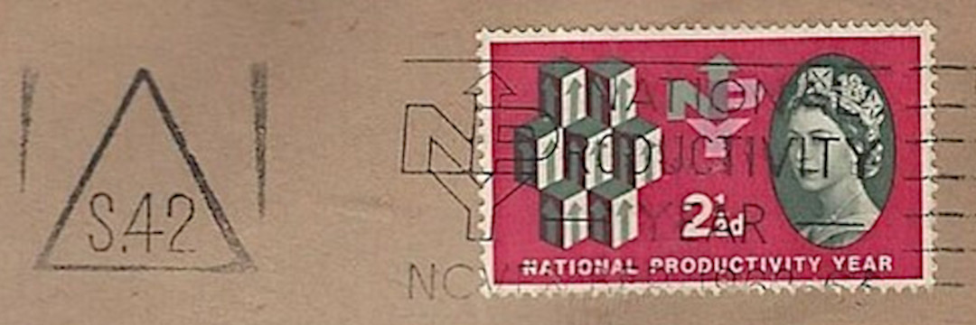
S.42 - National Productivity Year was 1962
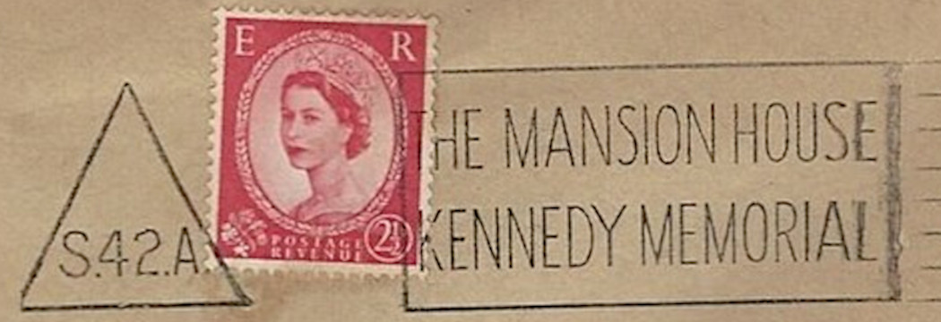
S.42.A - the triangles were being used in combination with slogan cancels.
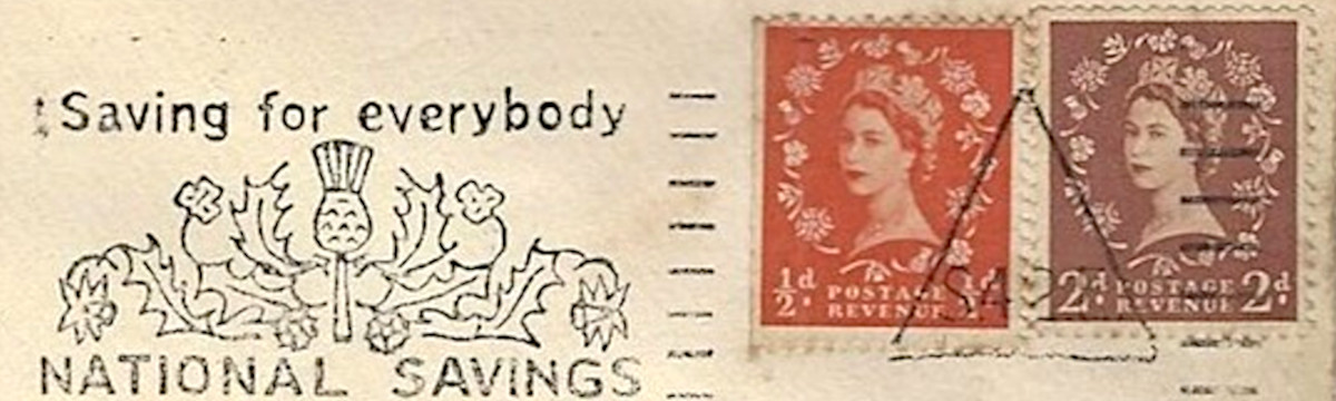
S.42.E ? - or Post Office advertising. — Listed on eBay by AlphaOmegaPhilately
Curt N. Fernau gives information on these triangles, and a list for London Offices on pages 21/2.
According to F. Hugh Vallency, 1950, the following codes were used in Irish Triangle Postmarks :
Comparing this with information from Post Office Circulars showed little overlap, but no disagreements, so I used this to update the table below.
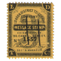
While looking at the Post Office Circulars, I couldn't help noticing all of the references to codes for the various Post Office Telegraph stations, including a few Railway Stations.
It implied that the Railway Telegraphs were a separate system to the Post Office System, though presumably they merged at some point if the Post Office was given a monopoly on telegraphs.
For what it's worth, I thought I would list the ones mentioned (more than I expected, but probably nowhere near the total).
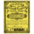
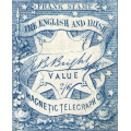
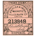
| Codes used : The Electric Telegraph Co was very much a pioneer and their methods were often copied. To some extent they had to be as they used the same type of equipment. When the Post Office took over their operations, the number of stations increased rapidly. They needed to use their own staff, with management unfamiliar with telegraph operations. A useful document explaining much of the internal workings is the PO form H2 with 32 pages. These codes were a way of connecting a sending station to the intended recipient. Large offices would have 2-letter codes with 3 letters for the smaller ones. The Post Office Circulars that were apparently issued weekly detailed among other things changes to the Telegraph network. Stations opened or closed, their locations, codes and name-changes. I presume there was an initial list, but I have not seen it. I have seen a PDF document of about 100Mb (PDF download) created by Allan Oliver which shows scans of the PO circulars for most (40) of 1878 and a couple of 1874. Additions would be welcome. |
| If you would like to send a message or picture, but don't have a scanner and/or you don't have email, you can still contact me or use webcam on my Comms. page. |
Last updated 25th. July 2026
©Copyright Steve Panting 2012/13/14/15/16/17/18/19/20/21/22/23/24/25/26 except where stated.
Permission is hereby granted to copy material for which the copyright is owned by myself, on condition that any data is not altered and this website is given credit.
![]()